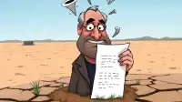



FAYETTEVILLE, AR – Local and state officials in Northwest Arkansas have commended the "remarkable efficiency" of the region's recent weather patterns, which saw two distinct tornadoes touch down within hours of each other on Tuesday. The National Weather Service confirmed the dual twisters, prompting a wave of unexpected optimism from civic leaders who now see potential for "streamlined disaster management" and "optimized recovery logistics" for future extreme weather events. The concurrent nature of the destruction, they argue, presents a unique opportunity for innovation.
"Traditionally, securing federal disaster relief has been a fragmented process, often requiring separate declarations for each significant event across a sprawling geographic area," explained Dr. Bethany Taggart, Director of Atmospheric Logistics for the Arkansas Department of Emergency Management (ADEM). "But with two distinct, high-impact atmospheric vortexes occurring in such close proximity, we're seeing an unprecedented opportunity for bundled federal assistance. It's like a two-for-one special on infrastructural rebuilding – a true economy of scale for meteorological distress." Dr. Taggart noted that ADEM is already drafting proposals for a "Consolidated Catastrophe Response Framework."
The regional Chamber of Commerce also issued a press release celebrating what they termed the "robust meteorological diversity" of Northwest Arkansas. "While nobody wishes for property damage, the undeniable truth is that our landscape is now uniquely prepared for large-scale, coordinated recovery efforts," stated Marvin 'Chip' Harrington, CEO of the Northwest Arkansas Economic Resurgence Alliance. "We anticipate a significant surge in construction bids, material procurement, and a heightened profile for federal grant applications. This isn't just about rebuilding; it's about rebranding our resilience as a beacon for efficient disaster capitalism." Harrington highlighted plans to host a "Recovery & Resurgence Summit" in the coming months.
Furthermore, state meteorologist liaison, Dr. Quentin Barlow, suggested the dual-tornado phenomenon offered invaluable data. "Having two major events hit sequentially within the same general region provides a rare 'A/B testing' scenario for emergency protocols," Barlow noted during a press briefing held amidst ongoing search and rescue operations. "We can directly compare response times, resource allocation, and even public information dissemination across two nearly identical disaster conditions. The scientific implications for optimizing future responses are enormous, even if the immediate human cost is, well, immediate."
Residents in affected areas, currently sifting through debris and assessing damage, largely expressed a muted response to the official optimism. "I'm not sure my insurance adjuster understands the concept of 'bundled efficiency' when looking at my garage, which is now just a collection of splinters across two zip codes," commented local homeowner Doris Perkins, who was quoted while attempting to retrieve a garden gnome from her neighbor's oak tree. However, state officials remain steadfast, suggesting the streamlined disaster response could serve as a national model, with the governor's office reportedly considering a "Dual-Storm Preparedness Initiative" grant application to the federal government as early as next week.
Critics, mostly living outside the direct path of either tornado, suggested the state might be getting ahead of itself, but conceded that it was an impressively efficient way to ensure everyone loses their roof at the same time.